
“How do I get there?”
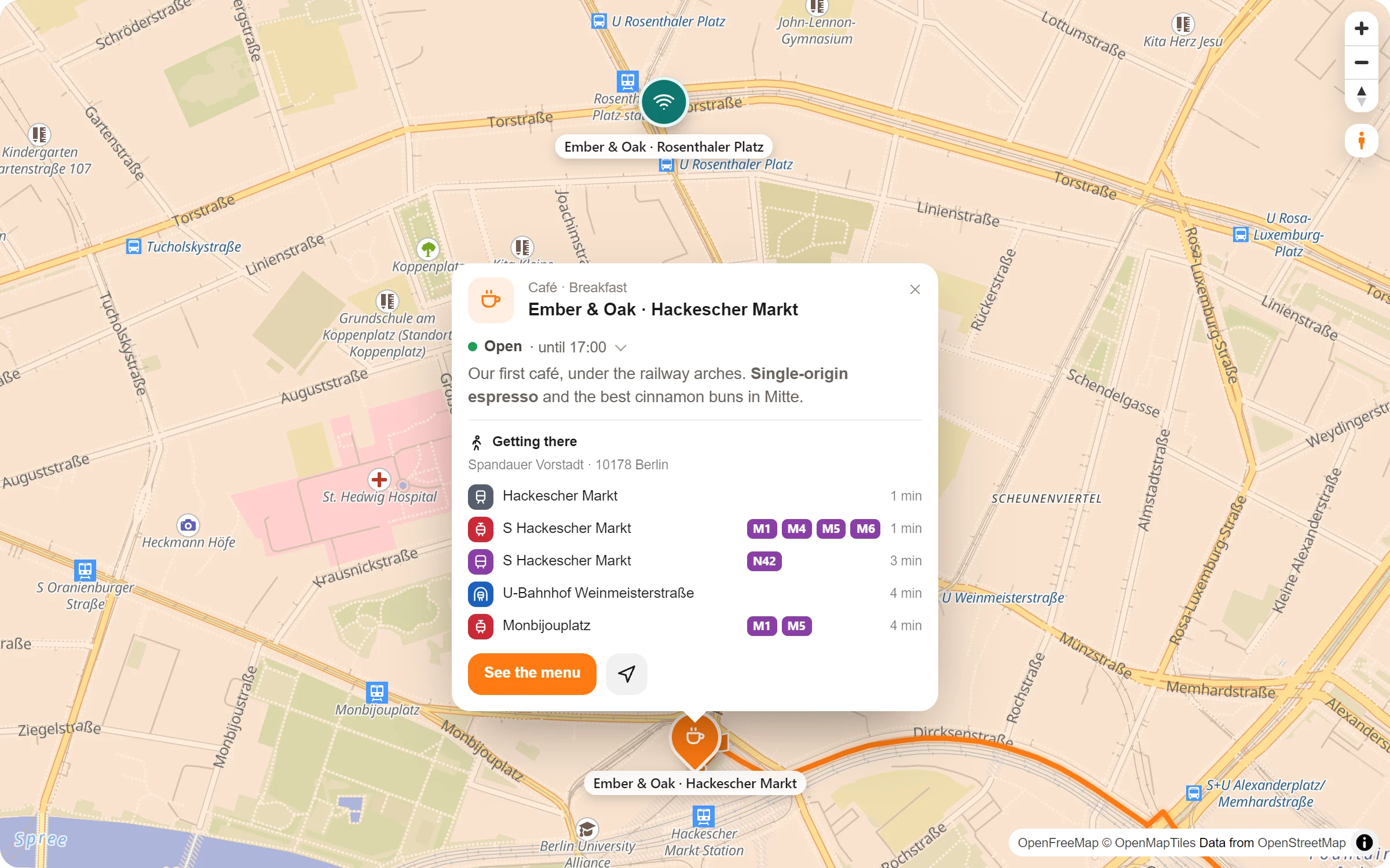
How do I get there? Your map answers it in the popup: the stops nearby with their lines and minutes on foot – and a button that draws the visitor’s own way to the place, on foot, by bike or by car.
The way to you, without leaving your page
Stops nearby
The nearest stops for underground, city train, train, tram, bus and ferry, with the minutes it takes to walk.
Their lines
Each stop with the lines that call there, and the part of town on top, such as “Mitte · 10178 Berlin”.
Their own way
“How do I get there?” in the popup: visitors type where they start or take their location, pick on foot, by bike or by car.
Time and distance
The way is drawn on your map, the whole of it in view, with how long it takes and how far it is.
Found for you, kept with the place
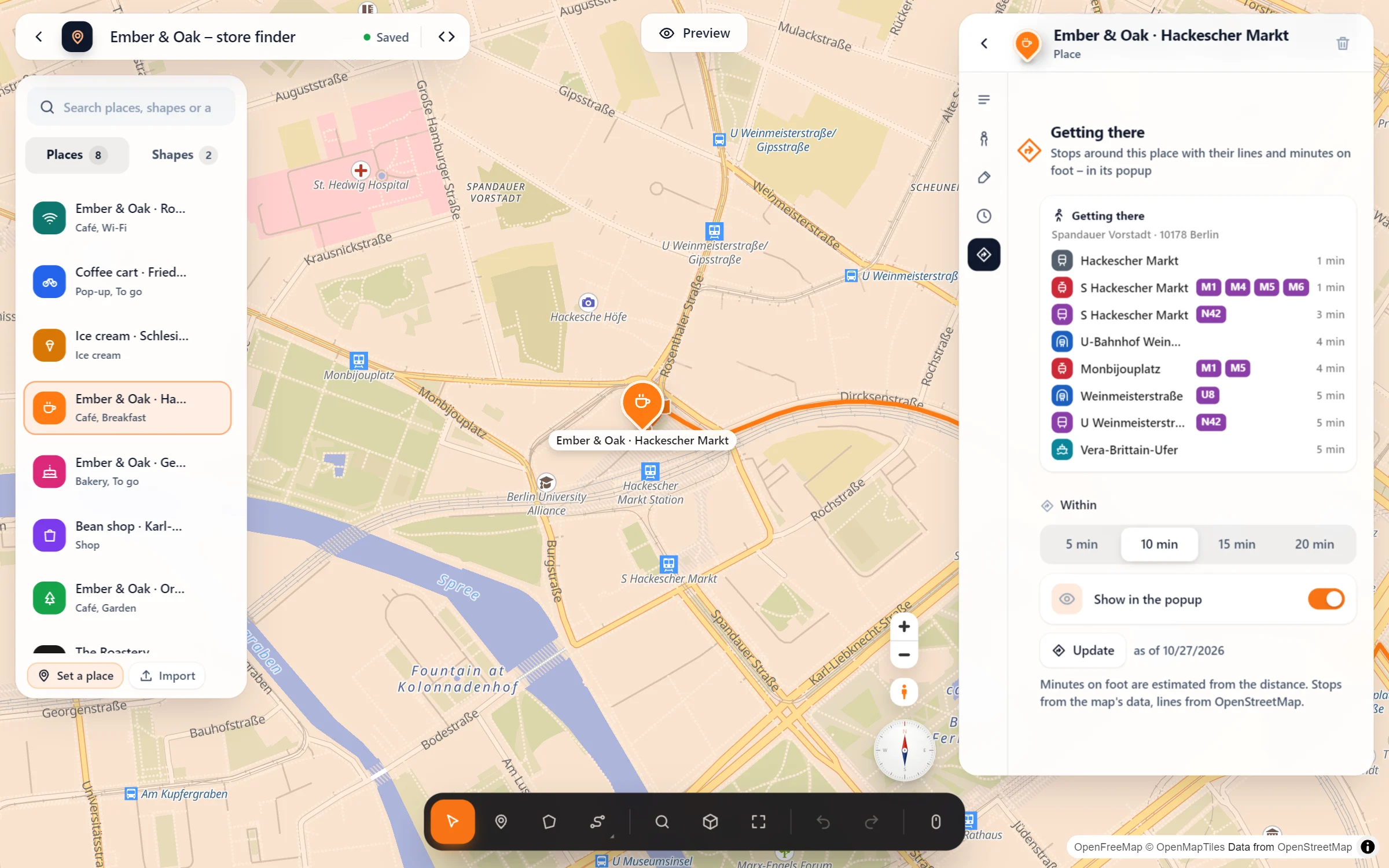
- Set your place. Type its address or click it on the map. With Map Studio Pro, every place can show the way to it.
- Open “Getting there”. Click the place → Getting there: it looks around by itself and finds the stops within 10 minutes on foot. Choose 5, 10, 15 or 20 minutes, switch “Show in the popup” on or off, and press “Update” whenever you like.
- Let visitors plan their way. Map Studio → Settings → Route planning: choose openrouteservice, GraphHopper or your own server, then switch on “How do I get there?” for visitors.
Questions people ask
Where do the stops and lines come from?
The stops come from the map’s own data and the lines from OpenStreetMap. Photon adds the part of town. They are looked up once in the studio and saved with the place, so visitors load nothing extra for them. The minutes on foot are estimated from the distance. With your own map data, the stops show without their lines.
Why can’t I use the free route planner for visitors?
The OpenStreetMap routers of FOSSGIS that plan your routes in the studio are not meant for every visitor of a website. For “How do I get there?”, choose openrouteservice or GraphHopper with your own key, or your own OSRM or Valhalla server.
What about privacy and my key?
The visitor’s browser asks only your website, and your website asks the route service. The service never sees the visitor’s IP address, and your key never reaches the browser. The privacy page in the admin lists it, with a ready text for your privacy policy.
Can strangers use up my key?
No. Your website plans ways only to places of your published maps, only within reach (25 km on foot, 80 by bike, 400 by car) and only so often per visitor and per day. For longer trips there is still “Get directions” in the popup.
Who helps visitors find the way
- Shops, cafés and restaurants
- Practices and clinics
- Hotels and guest houses
- Event venues and theatres
- Offices with many visitors
- Schools, clubs and town halls
Part of Map Studio Pro
Pro adds it to the plugin you already have. Everything in the free version stays free and complete.