
Routes
Type a start and a destination, and the route follows real roads and paths on foot, by bike or by car. Or draw it point by point. Either way it shows its length, start and finish.
- Ember & Oak · Hackescher Markt: Neue Promenade 4, 10178 Berlin
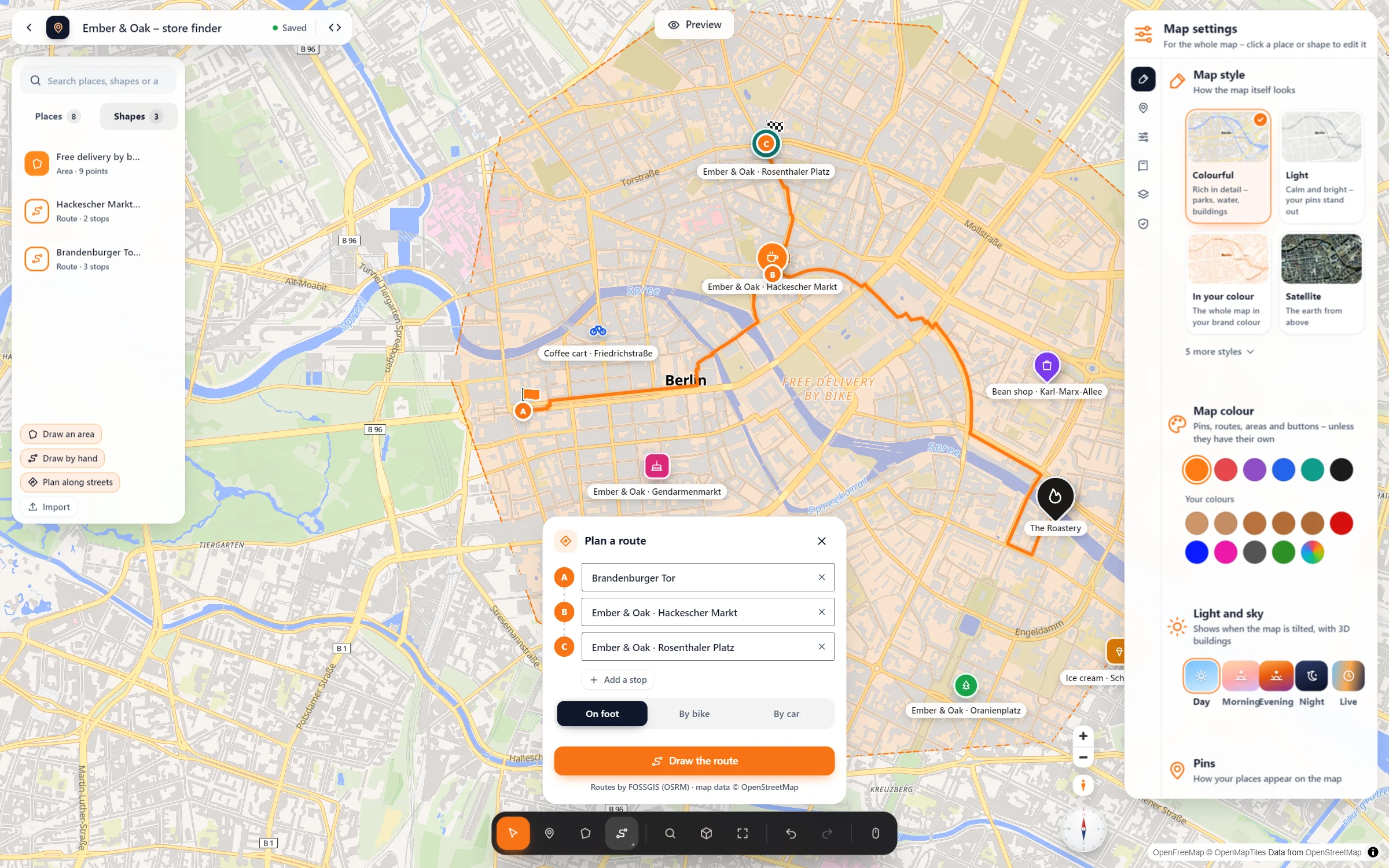
Live: this is the plugin itself, not a picture. A walk from the Brandenburg Gate along Unter den Linden to the café. Click the line for its length.
Every kind of way, on your map
Along real roads
From address to address, on foot, by bike or by car. If you drag one of the lettered stops, the route finds its way again.
Drawn by hand
Click point by point, either in straight lines or along the paths for walking, cycling or driving. Good for trails no router knows.
Start, finish, length
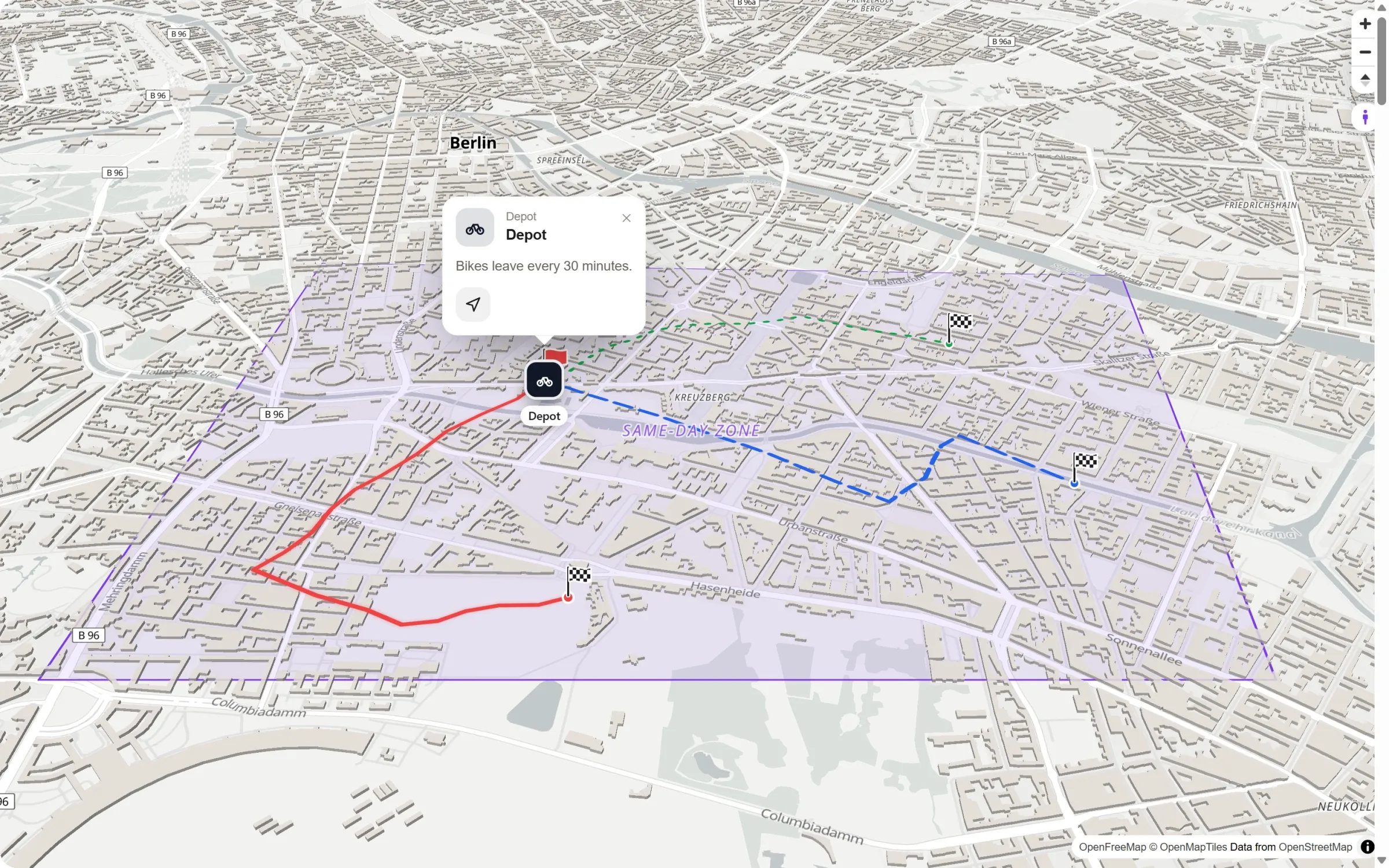
A flag at the start, a chequered flag at the finish, and the length for visitors who click the line.
Connect your places
Pick several places and “Connect with a route”. Move a place later, and the route follows.
Three steps, no API key
- Pick the route tool. “Plan along streets” for a route from address to address, or “Draw by hand” to click it point by point.
- Set the stops. Start, destination and stops on the way, each one an address or one of your places. Choose on foot, by bike or by car, then “Draw the route”.
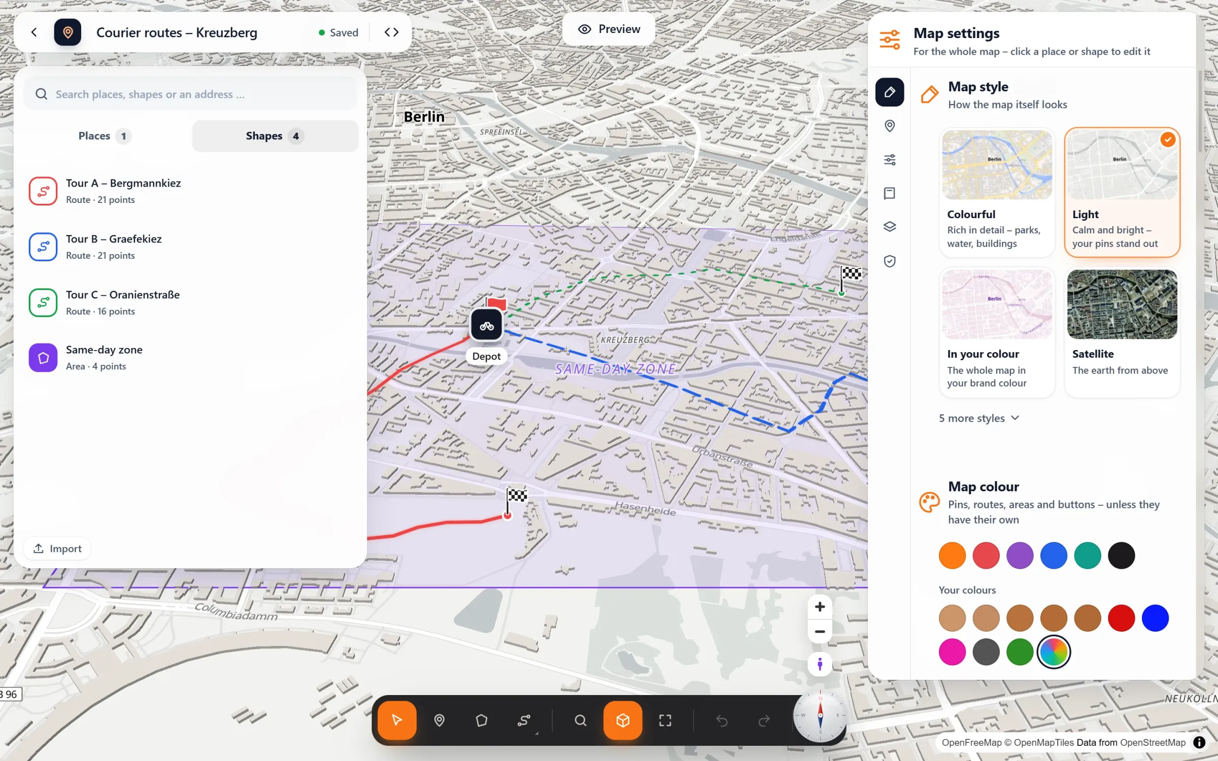
- Finish the look. In the route’s panel you set a name, “Start and finish”, “Show the length to visitors” and a colour. Under “More options” you’ll find the line width and the choice of solid, dashed or dotted.
Several routes, one map
Questions people ask
Do I need a key for routes along roads?
No. By default they come from the free OpenStreetMap routing of FOSSGIS. If you prefer openrouteservice or GraphHopper (with your own key) or your own OSRM or Valhalla server, choose it under Map Studio → Settings.
Does the route service see my visitors?
No. The route is planned once while you make the map and saved with it. Visitors only see the finished line, and their browser never asks a route service.
Can visitors find their own way to my place?
Each popup can have “Get directions”, which opens Google Maps, Apple Maps or OpenStreetMap. With Map Studio Pro, “How do I get there?” plans the way right on your map.
I have the route as a GPX file.
Pro imports it and shows its climbs as an elevation profile below the map. With “Ride along”, Pro can also fly the camera along any route.
Is it free?
Yes. Routes along real roads, routes drawn by hand, start and finish flags and the length are part of the free plugin.
In our guides: event map with the way from the station
Who shows routes
- City walks and guided tours
- Hotels and venues: the way from the station
- Courier and delivery tours
- Runs, rides and charity walks
- Cycling clubs and bike rentals
- Wedding days with several locations
Free in Map Studio
Install the plugin, open Map Studio and start designing. You need no account and no API key.