
Relief & 3D mountains
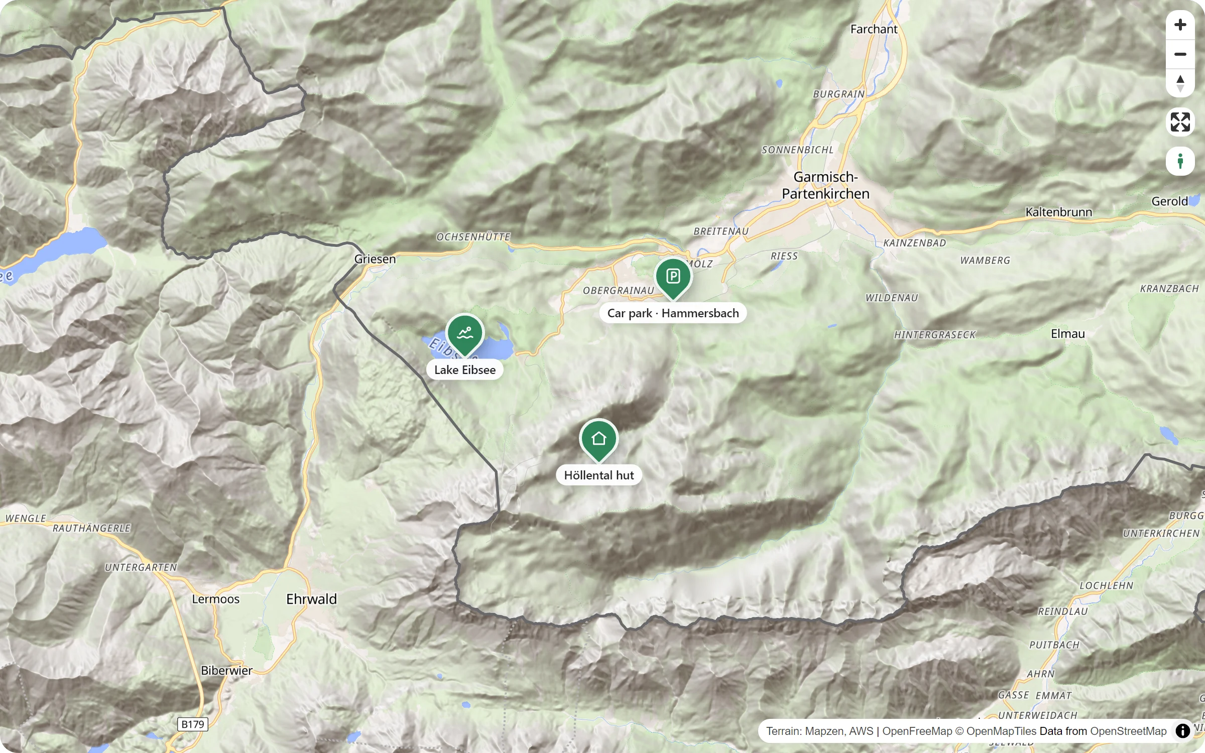
The Relief style shades every hill and valley under your places and routes. Tilt the map, and the mountains rise – the way a hiker sees them.
The land, not just the roads
Shaded hills
Slopes and valleys in light and shadow, under the roads, names and your pins. You see them on the flat map already.
Mountains that rise
With 3D on, the ground itself rises when the map is tilted. The height is slightly exaggerated, so the hills read well.
Smooth in flat land
Where the ground is flat, the map leaves out the rise by itself and keeps the shading. A tilted city map stays quick.
Made for routes
A hike from a GPX file, with its elevation profile below the map, runs over the real slopes.
Three clicks to the mountains
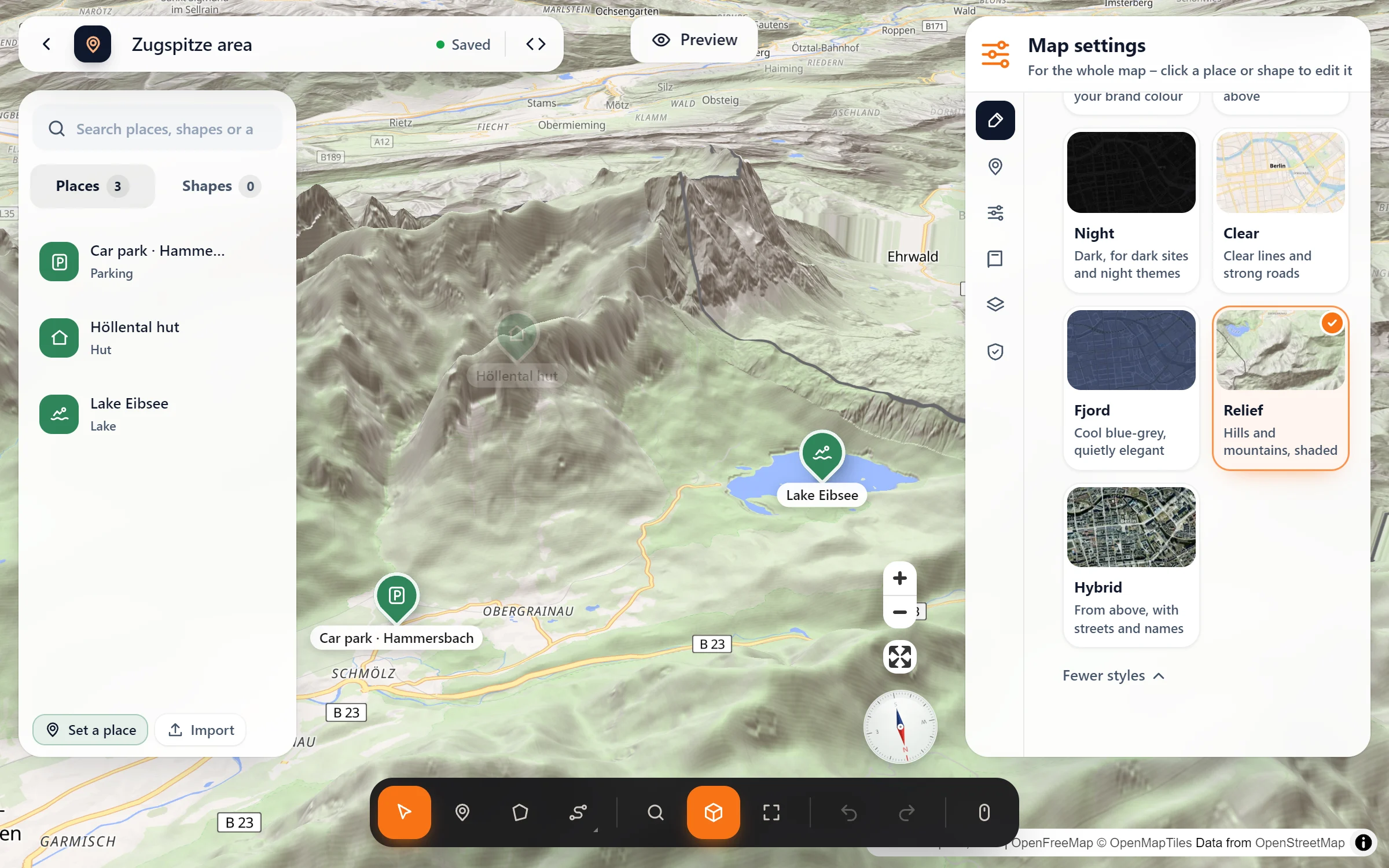
- Choose the style. In the studio: Map settings → Style and colour → “more styles” → Relief.
- Let the mountains rise. Switch on 3D (the cube in the tool bar at the bottom). Tilted, the ground now rises with the buildings.
- Set the view. Press “Preview”, turn and tilt until the valley looks right, then “Use this view”.
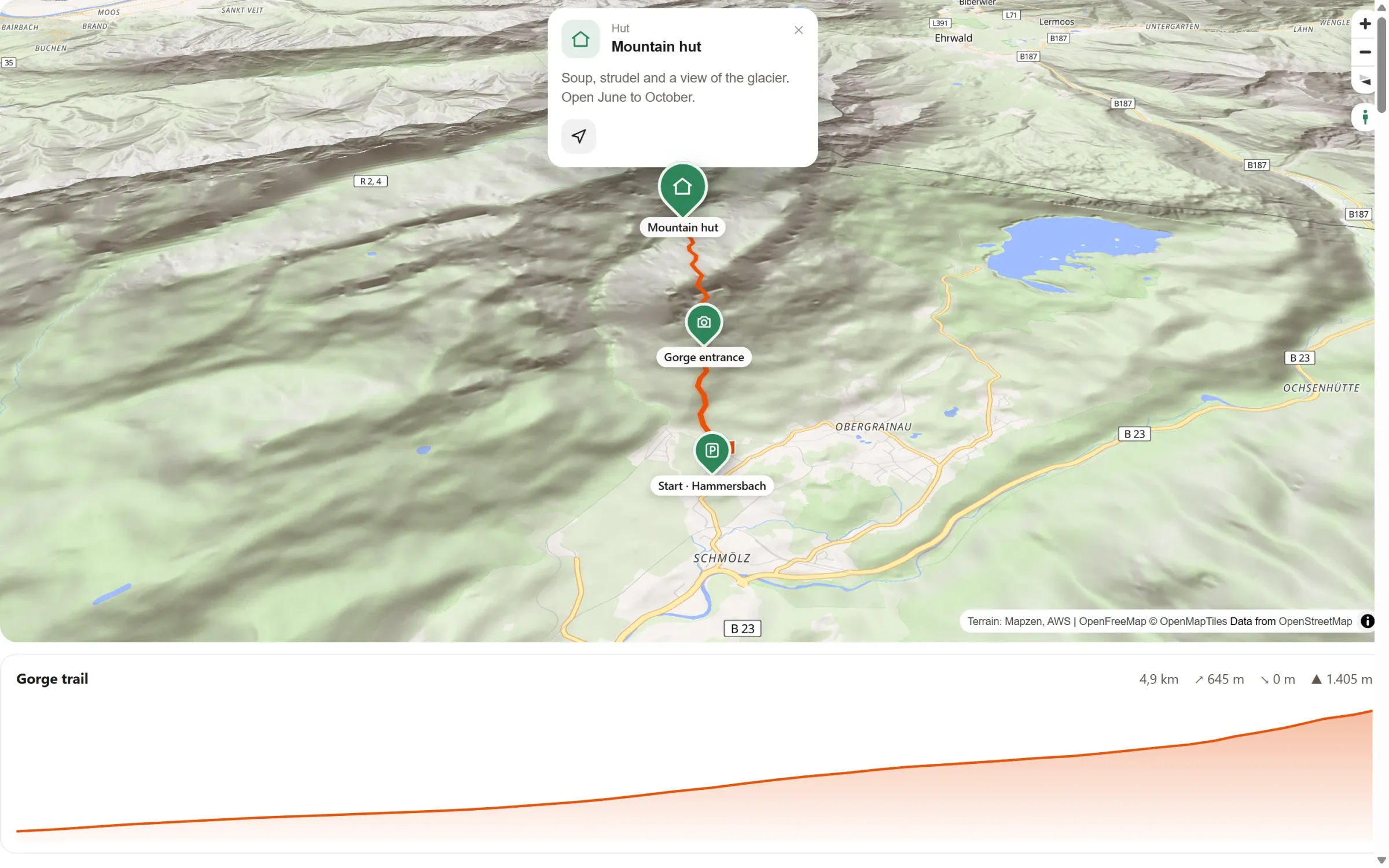
From above and from the side
Questions people ask
Is it in the free plugin?
No, Relief comes with Map Studio Pro. It needs elevation data from another server, and WordPress.org’s rules don’t let the free plugin load it. Everything else in the free version stays free and complete.
Where does the elevation come from?
From the free Terrain Tiles (Mapzen) on Amazon Web Services. The visitor’s browser loads them only on maps in the Relief style, not on maps in other styles.
What about privacy?
The privacy page in Map Studio lists the elevation data, and the ready-made text for your privacy policy names it. With load after click, the notice says that the elevation data come from Amazon Web Services. Visitors who already agreed to your other maps are asked once more for it.
Does it work with dark mode?
Yes. With “Follow dark mode”, visitors in dark mode get the night look, and the hills keep their shading.
Who needs the lie of the land
- Hiking and cycling routes
- Mountain huts and ski areas
- Holiday regions and tourist boards
- Trail runs and races
- Vineyards and farms on slopes
- Outdoor schools and guides
Part of Map Studio Pro
Pro adds it to the plugin you already have. Everything in the free version stays free and complete.