
Satellite & hybrid
Show your places on aerial photos – the roofs, the fields, the beach. Satellite shows the photo alone, Hybrid adds streets and names on top.
The place as it really looks
Satellite
The earth from above: the aerial photo alone, with your places on it.
Hybrid
From above, with streets and names: the bigger roads and the labels in white over the photo.
Your map on top
Pins, popups, areas and routes work as on any other style. Draw a plot, a terrace or a beach right on the photo.
Your own key
The photos come from Esri World Imagery, with a free key of your own that you enter once in the settings.
Photo alone, or with names
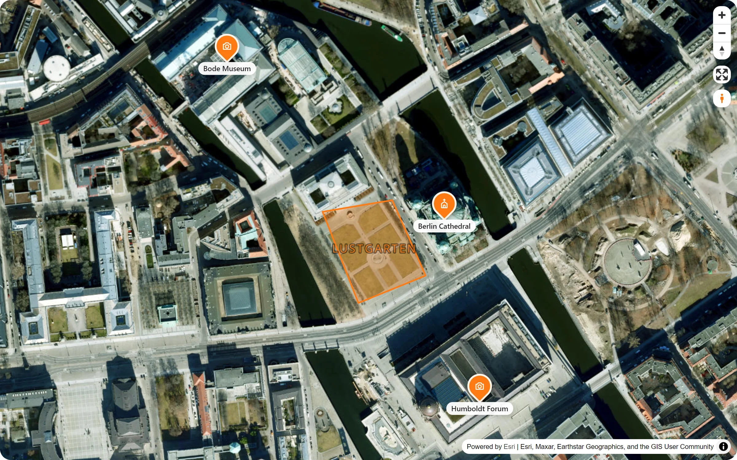
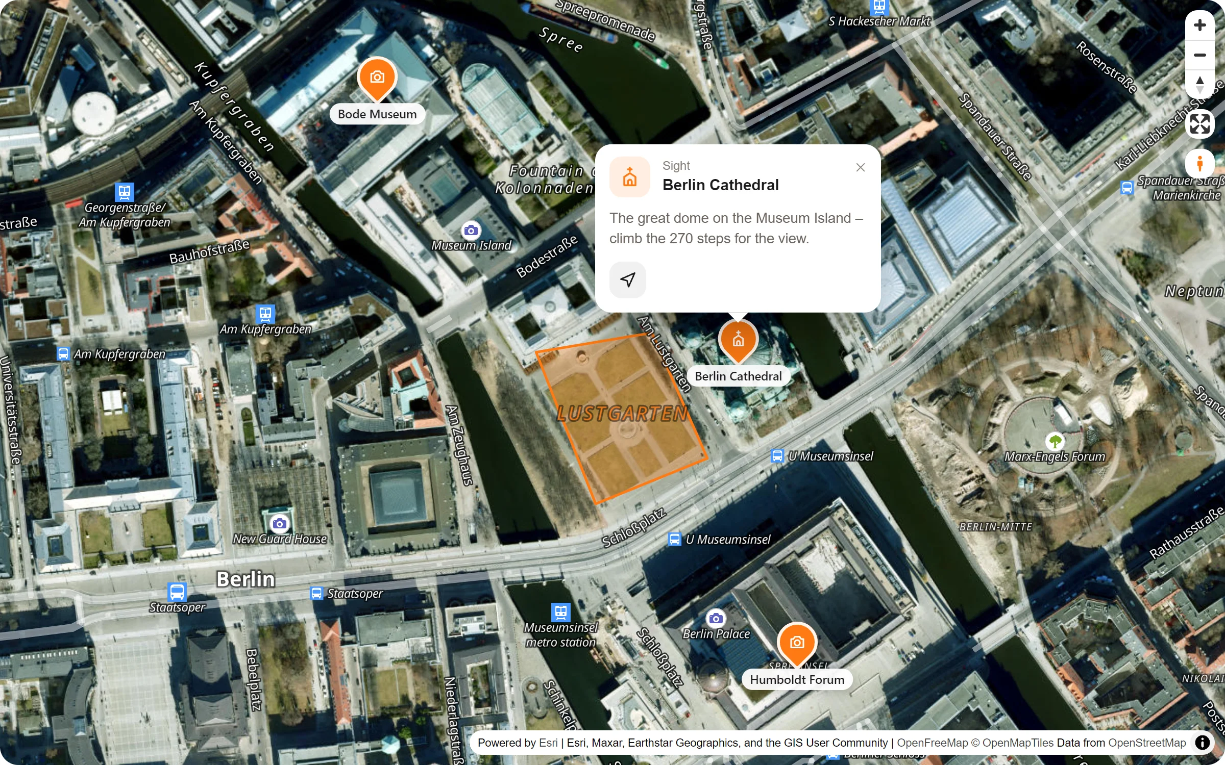
A key once, then a click per map
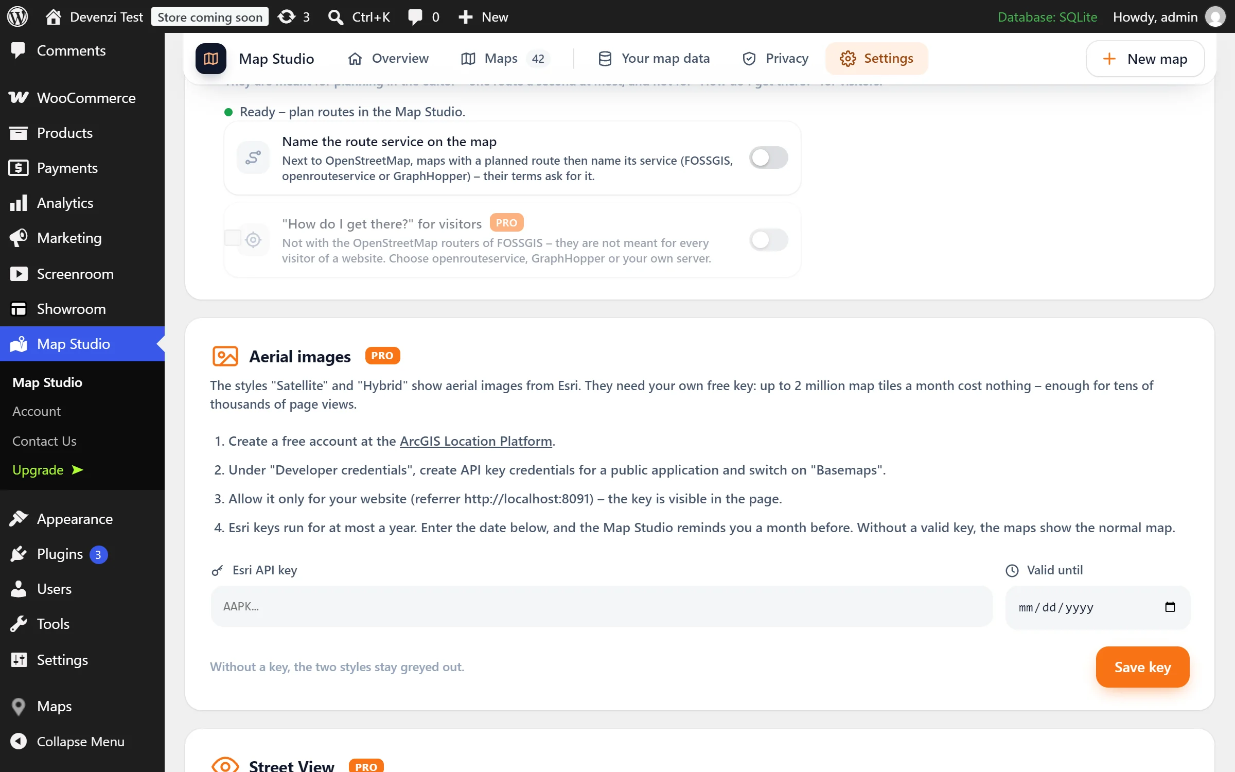
- Get a free key. Create an account at the ArcGIS Location Platform, make API key credentials for a public application and switch on “Basemaps”. Allow the key only for your website.
- Paste it into Map Studio. Map Studio → Settings → “Services with your own key” → Aerial images. Add the date it runs out, and Map Studio reminds you a month before.
- Pick the style. In the studio: Map settings → Style and colour → Satellite, or Hybrid under “more styles”.
Questions people ask
What does the key cost?
For most sites nothing: Esri’s free tier covers 2 million map tiles a month, which is enough for tens of thousands of page views. Satellite and Hybrid themselves come with Map Studio Pro.
What if the key runs out?
Esri keys run for at most a year. If a key has run out or isn’t allowed for your site, the maps don’t break – they show the normal map until you paste a new key.
Can visitors see the key?
Yes, it is part of the page. That is why you allow it only for your website’s address, so it is of no use anywhere else.
What about privacy?
The visitor’s browser loads the photos from Esri (USA), and only on maps in these two styles. The privacy page in Map Studio lists it and the ready-made privacy text names it. With load after click, visitors who agreed to your other maps are asked once more for the aerial images.
Who shows it from above
- Estate agents and plots for sale
- Campsites and holiday parks
- Golf courses and sports grounds
- Event sites and festivals
- Farms, vineyards and gardens
- Beaches, marinas and harbours
Part of Map Studio Pro
Pro adds it to the plugin you already have. Everything in the free version stays free and complete.